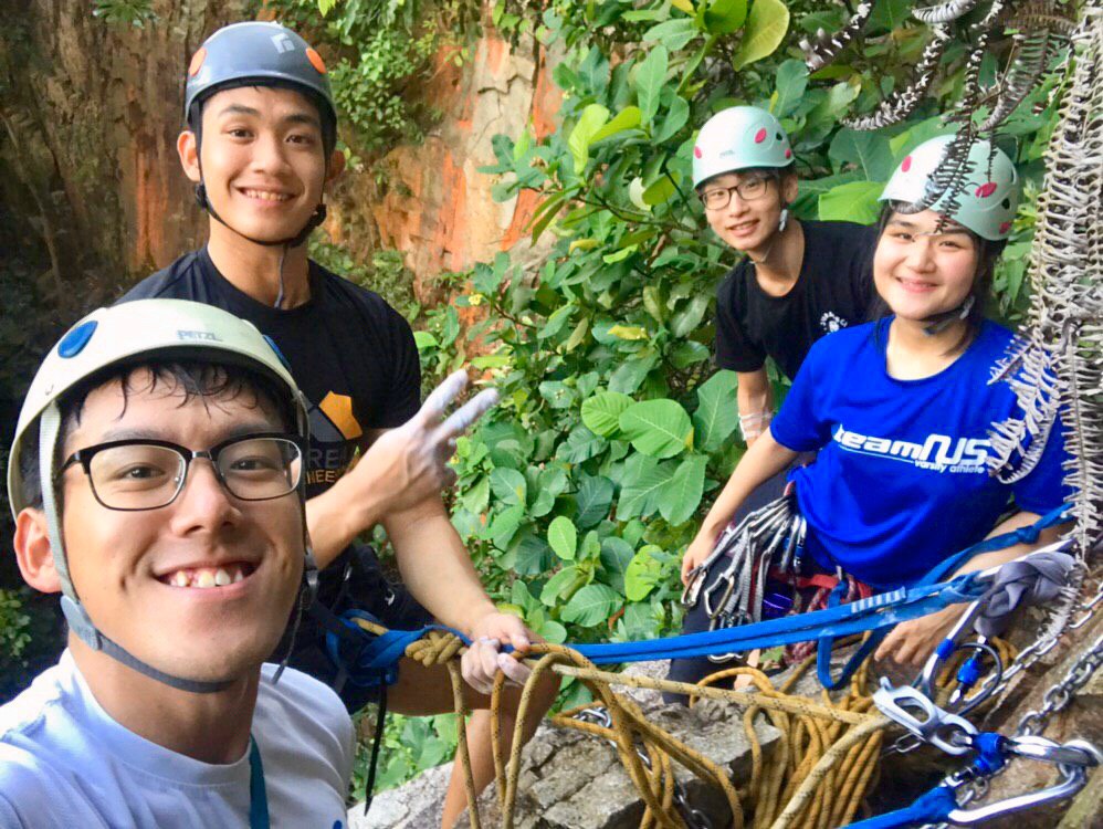
Six months ago, after a weekend handover, four of us officially inherited MIR from Nicholas and the batch before. There we were, sat at the U-Town rock wall on a Sunday evening, wondering about many things – prospects, ambitions, challenges. But above all, one thing persisted – how were we going to carry the torch to inspire mountaineering in and through the club? Of course, we were bubbling with unbridled enthusiasm, with no idea or direction whatsoever.
After endless back-and-forths, we knew, for a fact, that we were sick and tired of the perpetual dilemma of “so…what’s next after TMC?”, that we took it upon ourselves to head out on an unguided, unsupported expedition to the Southern Alps. Why? The choice of New Zealand was apt for many reasons – for one, MIR had previously functioned out of the area in its founding years, specifically Kelman Hut. The then-TMC model proved obsolete soon enough, and we learnt why – for one, choppers were exorbitant, and if you ever want to see true erratic weather, New Zealand’s the perfect place. Not good for a bucket-list-seeking, Instagram-worthy “wanderlust” traveller, but great for character-building. Other reasons for the choice of location included it being an English-speaking environment and straddling evenly between established and less-travelled. That said, none of us had experience outside the Himalayas – which I today blame for our often disillusioned and romanticised view of mountains and mountaineering, because of the comforts the range and culture offer.

We’d continued preliminary chats in our squeezy motel room in KL, after having just done a little 4-pitch project, 2000 Steps, in Bukit Takun. It was messy – no one knew how to start. We knew we wanted to climb around Aoraki Mount Cook, but what next? Lost. So I thought it made the most sense to just order the $100 latest edition of an Aoraki / Tai Poutini guidebook by Rob Frost, off the New Zealand Alpine Club’s site. It arrived a few days later and I studied it cover to cover for months leading up to the trip. Our initial plan to budget our trip as best as we could deterred the use of choppers, which we soon realised was atypical, especially considering the Southern Alps’ typical terrible climbing conditions, making access to virtually everything difficult. Even a I, 1 technical climb (Learn about NZ Frost Grading System here) would soon prove tough – due to its scrubby and long approaches, rotten rock and slushy snow. And that’s assuming weather conditions were ideal. Trust us, we learnt the hard way.
So we were six months to flying, and from scratch, we had to plan everything. It proved to perhaps be the most uphill task we’d ever put our hands and heads to – on top of our concurrent ExCo and academic commitments, the physical and technical training were the easy parts. The independence was challenging. We soon became obsessed with the trip – Chiew Hui, Gawain and I will spend late nights, after wall sessions or trainings unhealthily musing over a 14-point agenda I’d created.


We didn’t know what we didn’t know, so we had to fixate on the tiniest of details. We had to PLAN. We were rejected any support from the school because of our trip’s unguided nature. We worked jobs to raise funds for the trip. We talked to people like our club’s pioneer Kim Boon who had experience in the Southern Alps to review our plans. Chiew Hui took it upon herself to work part-time at Adventure21 to gain knowledge about equipment and get hefty discounts on some of the gear (some which future batches will get to enjoy too).
I recall I had sleepless nights, staring at the A0 topo-map I’d plastered on my wall, wondering if the routes made sense. Our plan was straight-forward and in phases: (1) Climbs out of AMCV, (2) Climbs out of Mueller and Barron Saddle Huts and (3) Climbs from the Frind-Mueller confluence. Principles were simple: climb fast, climb light, climb hard, climb unguided, climb unsupported. Idealistic or delusional – you draw your own conclusions. We drew ours. It was soon time to fly. We had plans we thought were solid as hell, down to the calorie, and the gram. But of course, they changed. DRASTICALLY, and we learnt how inadequate we were for the style of expedition we were attempting, but that soon revealed itself to be the greatest learning point as well.
Now, before actually talking about what happened in Aotearoa, Gawain and I had once in the semester came across an article – Reinhold Messner’s What I’ve Learnt feature on Rock and Ice. Even attempting to comprehend his sheer brilliance will be a pure insult, but I guess, both of us wanted, to some extent, to resonate a little. He spoke about failure, goals, responsibility and successful partnerships, on top of several other things – at that point, we quipped that we empathised with his words. How pretentious of us.

We were off. Upon landing – chop-chop, off to NZAC for the poo-pots, Complete Outdoors for remaining gear, fuel and 21 days of freeze-dried gourmet Backcountry rations (I say ‘gourmet’ cos goddamn, they were worth savouring when you were starving), a random guy for an inReach and Iridium sat-phone, and then packing and re-packing. It was straight off to AMCV the next day where we picked up avalanche transceivers from Alpine Guides, declared our intentions at the Department of Conservation (DOC) Visitor Centre, became enthralled by Hillary’s influence on the Kiwis and how The Hermitage had clearly leached off his legacy to pander to pesky tourists, and shifted some plans around.
The history tour on the bus-ride there (though boring as hell) taught us briefly about how the Southern Alps came to be – cementing the Māori’s spiritual connection with maunga (mountains). No brief would do justice to Aoraki Mount Cook’s spirituality. Here’s a better account. As visitors to the place, we tried our best to keep in mind the need to respect the local way of life. Even though the mountaineering history of the region was plastered all over the walls of The Hermitage, our well-accessorised packs made us stick out instantly like sore-thumbs. We got glares. Many glares. From the DOC staff, the search and rescue people, and from the droves of tourists.

Early the next day, we checked out of proper accommodations, and were to commence living outdoors for 3 weeks. Our first objective was Mt. Edgar-Thomson, 2,379m. Edgar-Thomson was sheer beauty – for one, we found ourselves, after an hour’s walk, at the foot of its allure, hoping to get to the top that same day. No base camp, no guide, all alone. It was the first time that it dawned on us how different this was from TMC – there was no certainty of getting anything right, and we were left to assess our own risks and comforts. One semester’s worth of planning couldn’t prepare us for physically looking at a mountain face, 1,600m of prominence lower and deciding if it was possible there and then. There were endless things running through our heads at that point, but one thing was for sure – if we made the summit that day and descended safely, it’d definitely boost our morale for the rest of the trip. I wanted to get to the top and I wanted it badly.
A I, 1+ climb via the South Face and the very first of Frost’s list, Edgar-Thomson was in plain sight and aside from a slight drizzle, it seemed like perfect conditions that day. We were gung-ho enough to bash up at least 300m of thick scrubs as we had to circumvent a gushing river which had cut off usual access towards the high pass. We had lost a lot of time, but I was feeling strong. We made the scree slope by noon and I could see the saddle at least 200m in front. It didn’t take long for the mountain to put us in our place. I’ll take that back – more like throw us a slap in our face. By then, the approach had killed most of us. Our failed navigation was a huge demoralisation, and it didn’t help that Chiew Hui had become physically-incapable to get up the scree safely because of an existing injury.
We had set off at 5.50am and by 11am, Gawain had looked me in the eyes, saying we had to bail. We hadn’t even gained the saddle. Deep inside, I was pissed. What a way to start the trip. With failure. And it’s only because my measure that very day was to summit, and nothing less. That was a defining moment of humility I had to learn from, and as we reversed our route back to the road, with the Sealy Range behind us, it became evident we had a long road ahead of us. Learn to fail, or you’ll fail to learn, it seemed. I found the sublimity of the team shrugging after the long-ass descend, back at the foot of the mountain picturesque.
I was never ever putting in a 12-hour long approach to fail again, I was never coming back to Edgar-Thomson. It was time to move on with our plans.

The next couple of days saw us getting used to living out of our tents at White Horse Hill Campsite (WHHC), and our stomachs slowly shrank to accommodate the shared 3-serving Backcountry freeze-dried rations we had. Per meal. Some meals were just 1-2 nutty bars. And then it came – the real weather. The valley WHHC was in, geographically, saw a confluence of strong winds frequently carried in from the western coast, through the valley and off the surrounding high peaks. These moisture-laden gales often brought so much rain that it flooded the campsite perpetually.
We abandoned subsequent climbs, and stayed cooped in our tents (or desperately sought shelter when it got real bad). Well, of course, things got real bad. One morning, Jin Hao and Chiew Hui awoke up to a flooded tent. Let’s just say that that fried some equipment. Our emotions well-paralleled the weather – the bad days were really shit. I admit, there was one evening where I was near my tipping-point – my stuff had been soaked too, and in the heat of recovering our gear, I’d accidentally drawn two tears at the base of the Hilleberg with my ice-axe and water started coming in.
That night, I’d lost it – we had only climbed once in the first four days, and failed at it terribly. We were waiting for god-knows-how-long to head out but the weather was incessantly horrid. We never accounted for that. I was tired, hungry and recall shouting to Gawain – why did I work my ass off only to spend $4000+ on a trip to not climb, to inspire people who clearly didn’t give two hoots. I was obsessed with doing our hardwork justice that I couldn’t justify what I was doing here. That night, I was faced with something inherently paradoxical – how this trip, right from its inception, pit club versus personal ambition against each other, and that dilemma became increasingly hard to reconcile. But the saving grace was Gawain’s patience to convince me to come out of this stronger, and to keep it together because weakness would be the contrary. Weakness would be bowing down to discomfort, which I did that night.
The Southern Alps, we soon learnt, would give chances very occasionally. Pockets of good weather, represented by distant isobars and weather maps clear of low-pressure reds. We had to make full use of these rarities to climb. Good weather became more precious than a bag of freeze-dried two-serve Nasi Goreng. The next window, while Chiew Hui nursed her injured ankle, the rest of us rushed out to attempt Mt. Sealy from its supposedly more accessible South Face, via the Sebastopol Ridge. It was nearly one week into the trip and after lugging our snow and ice gear everywhere, we’d yet to don our crampons even. Getting to the snowline was THAT tough. We were craving it at that point.

After gaining Red Tarns, we broke track and were faced with another navigation crossroad – the Sebastopol Ridge, we had learnt earlier on, had extremely bad rock (DOC called it ‘New Zealand rock’, typical for its choss), which offered no protection and in the worst circumstances, forced climbers to steer clear of the ridge, onto the dangerously-exposed icy headwalls. Go left onto an easy vegetated slope towards what seemed like a saddle, or head right, up bad scree nearer to the entrance of the Annette Plateau? Our safety margin, we realised, was small due to that uncertainty – while we had sufficient gear on us, we weren’t confident of the rocks holding any protection.
We chose what seemed like the option of least resistance and 3 hours into the climb, were faced with multiple exposed often-times boulder-like problems on crumbling granite to get through, only to be blocked by a giant headwall, with steep moraine drops on both sides. Continuing would require a trad-climb, nearly 1,400m high, and falling would’ve been fatal. At that moment, we realised we were way off course – in retrospect, the saddle would’ve been better gained via the other option, and while we were 40m below the peak of Mt. Sebastopol, we were clearly lost – absolutely no one would’ve climbed the route we did, it was way too dangerous.

Certainly not II, 3 as the guidebook advised. As we stared at Mt. Sebastopol, and the route down, we became fearful that we’d gone too far in to retreat safely as the down-climb would be precarious. But moving forward was not wise either – bailing was the only option. Yes, we were going to give up for the second consecutive time – we hadn’t even made Annette Plateau, much less camp out on the Metellile Glacier. Unlike Edgar-Thomson, I could swallow this better because I knew we’d taken a gamble and gotten the route wrong from the start. It was sad – still no proper climbs, no snow and back to camp.
In the days that followed, we became known around AMCV as the ‘Singaporean group’, for good reason. We stuck out because no one really climbs around the area like the way we did. Not anymore. Almost everyone that visited AMCV were selfie-stick, slinging day-trippers. We had sharp ice-axes sticking out of our packs, occasionally walking into DOC. Where the hell were the climbers? In terms of what we’d experienced so far – there were many reasons we hadn’t met ‘them’. Things were less than ideal out here, so why come HERE when you could be in Chamonix getting in good climbs, at high altitude, on impressive routes, with excellent conditions?
But there was a silver-lining in this – the DOC personnel became our unlikely ‘guardian-angels’ so to speak – you see, the Kiwis clearly wouldn’t want anything to happen to climbers they’d met so they’d do everything in their power to advise you well. Which is also why emergency rescue and medical are all free if shit really hit the fan. We became well-acquainted with DOC staff (shoutout to Margie and Pip!) who’d ensure we had the latest weather updates and redirect our plans. We also figured how most of the climbs we’d intended had to be scrapped – for one, the Mueller Glacier was impossible to access anymore, due to, well, climate change. It had left the glacier exposed to dangerous moraine, to the extent that even the most experienced mountaineers wouldn’t set foot anywhere past Barron Saddle. What now? I knew plans would change but why the hell didn’t Frost ensure these climbs were struck off of his 2018 guidebook? Turns out – climbers decades ago who’d made FAs up classic peaks like Maunga Ma risked being offended if these mountains disappeared from the face of newer editions.
We reconvened with Chiew Hui in AMCV to think about what was next. Two ‘failed’ endeavours. What was possible to attempt wasn’t an issue of skill and technical competency anymore, but actual resources, access and practicality. It became evident we should just make Mueller Hut as early as we could, about 1,000m higher, and try to get to the Sladden Glacier for climbs that were still possible. As we chatted in the mildly-quaint Old Mountaineers’ Café, which was opened by Hillary himself, a man with a walkie in hand appeared out of nowhere and demanded to know who the ice axes clipped to our packs belonged to. We owned up. We thought he was a server – but upon introduction, realised he was Charlie Hobbs – owner of the café, an IFMGA mountain and ski guide, and one of the most renowned mountaineers in Aotearoa. An ascent of Everest via the gruelling Tibetan face, multiple first ascents in Antarctica and authoring a series of famed mountain literature – these only scratched the surface of Hobbs’ achievements. A close friend of Hillary himself, this guy was legit – in retrospect I wished I got a picture for posterity – check out his achievements here. He unassumingly asked if we knew of David Lim, and reminisced, having met him in the mountains before.

Before Mueller Hut, we decided we’d give Edgar-Thomson one more attempt. It was a simple case of the allure of the mountains demolishing the bitter memories prior. Though I had resolved to never go back, we quickly found ourselves at the entry of the dirt road that led to the mountain a day later. One more try. Because our Garmin had recorded the non-scrubby descend route we had taken the first try, we had the advantage of circumventing the thick vegetation and river, to gain the scree access in better time by reversing the route. The morning clouds gave way to a clear look at Edgar-Thomson, Sealy and behind us, Aoraki. I subtly recalled Anker’s jubilation upon first catching sight of the Shark’s Fin in Meru – there were some parallels, I guess. We moved extremely fast – gaining the saddle, and finally our first glimpse of ice.


The night before, heavy snowfall had introduced a thick, new layer of snow along the slopes, which made our ‘crampons-point’ (borrowing a term from TMC) a lot earlier than expected. Having strapped on our crampons and ice-axes, we chose soloing over roping up. We were somehow rather confident that day. Flashbacks to TMC, but this time all alone – we had the mountain to ourselves, there was absolutely no one in sight for miles around. It felt free – we were free to choose, to decide the risks, and make our calls. I took lead, and we gunned for the highest point above. As I rushed to the top, I was greeted by a comparatively-steep incline to a higher peak northwards. Were we at the summit? We wished, but became mildly disappointed when the GPS told us otherwise. The actual summit meant another 2-hours climb forward and upwards. When the realisation dawned on everyone, we were disappointed, of course. Yet, at the same time, though, we were elated. We had gotten up to the ridge of a mountain in the middle of nowhere by ourselves, for the first time.

We snapped a 360-photo with the MIR flag, took in the sights and bade Mt. Edgar-Thomson farewell before heading down. We’d often hear that bailing was part of the game – my months of reading past trip report of climbers in Aoraki only cemented that impression. Everyone here bailed, countless times. Steve House preaches the idea of failing well and that day, we were a little closer to appreciating that mantra. That climb was defining as it kind of rebirthed what mountaineering meant to us. It symbolised the self-reliance we were seeking, which, for the rest of the trip, evidently translated to growth. We hurried the descent, and just before the sky darkened, reached WHHC for a good night’s rest – the best yet (cos for goodness sake, our tents were dry!).


Days of bad weather followed, until a small speck of clarity in the charts emerged. We had only a few hours in the evening to make Mueller Hut. And we decided there was no better opportunity – packing up everything, we lugged about 30kg (each) of load up Sealy Tarns towards Mueller Hut. Never act like you understand weather – things always change. Even before Sealy Tarns, rain, then snow, befell and drenched us to the bone. Sealy Tarns was a common track for tourists – it’s easy to negotiate the steps, albeit steep. After Sealy Tarns, the track is replaced by scree. The moisture from the rain didn’t help our approach – and the only aid we got was from these orange markers which demarcated our route towards the hut.

As the sun disappeared from the horizon, we realised something funny – the markers weren’t exactly luminescent. Swapping leads and depending on the GPS, we trudged our way through the snow. Somehow, shallow footprints from a climber two days prior revealed themselves and soon became our saving grace. They guided us through the night while we kept our eyes peeled for dark outlines of marker poles. As we made our way through the snow, we kept hearing the sounds of thunder ring out. Well, there were no thunderstorms. The crackles and whumpfs were avalanches. Clearly unbeknownst to us, the great Mt. Sefton and The Footstool were just to our right, not far away. The darkness concealed this, till the next morning. Soon enough, the dim light from my headlamp eventually struck a roof that looked out of place against the pitch black.

The original plan was to set up camp outside Mueller Hut, to avoid paying the hut fees. But that probably wouldn’t have been wise that night – plus, Mueller Hut and its surrounding infrastructure were almost a quarter submerged in unconsolidated snow. We kicked a chunk of snow off the heavy metal door to the hut, and tip-toed our way in. It was 1am and we’d assumed the hut was full, because of DOC’s projections earlier. As we entered the small, but well-insulated common area, we rendered a guess that the two bunk rooms might actually be empty. We were right – even the hut warden wasn’t in. Surprisingly, we had Mueller Hut entirely to ourselves. Of course, no one else would’ve been ‘wise’ enough to have made the trip that evening. Out of respect for the place (and the fact that technically we weren’t supposed to be there), we just unrolled our sleeping bags and slept in the common area for the night. I take back my earlier words – this was the best night ever. I wished I had images of the pristine night-sky we were rewarded with.

The next day, we were greeted with fantastic weather conditions. Absolutely spectacular – the landscape was enveloped by fresh layers of snow. Mt. Ollivier (1,933m), which stood just behind the hut, was entirely different from what I’d pictured when researching the route. Unlike its Wikipedia image, we were facing winter conditions in the middle of summer. What was supposed to be an easy rock scramble got a little bump up – we ascended Ollivier from its south face – a friendly snow slope and a quick traverse to the real summit marked out by a pyramid of stacked granite rubble.


Hillary himself had stood here decades back in 1939; Ollivier had marked his first major climb in his remarkable mountaineering career. After Hillary’s death in 2008, there were proposals to rename Ollivier Mt. Hillary as a memorial, though this was vehemently opposed by Arthur Ollivier’s family.

As we enjoyed the view of Ollivier getting well-dwarfed by Sefton, The Footstool and Aoraki’s sharp razor to the right, Jin Hao’s phone began sounding and a flurry of text messages came in. We hadn’t received internet signal for the past day but Ollivier’s high point allowed for a direct line back to AMCV. It was then when we discovered that the Winter TMC team were facing issues, and we scrambled to get a couple of texts in. Yup. We had an ExCo meeting on the summit of Mt. Ollivier. Forget first ascents. This was probably the highest-altitude MIR ExCo meeting ever.

We quickly retraced our steps down, only to be greeted by a slow trickling in of trekkers who had capitalised of the thawing of snow to achieve their bucket-list ascends of Mueller Hut that morning. Ugh. there’d gone our precious solitude. The rest of the day was great – so we decided to spend the afternoon justifying our club’s purchases of ice-screws, micro-traxions and ice-axes by putting into practice crevasse-rescue techniques, and various anchoring methods. It felt good to finally apply these skills in real snow conditions and observe what worked and what didn’t.

In one rescue attempt, Chiew Hui’s two snow picket anchors had flown out as the load wasn’t distributed evenly, so basically Jin Hao (the mock rescuee) would’ve perished. Finally, ensuring proper equalisation of our snow picket anchors and fixing the lip with our ice-axes to aid the hauling made sense, and it wasn’t just doing things for the sake of it.


As expected, the next few days were met with disastrous weather conditions. One night – the gale winds were so strong, that it shook the hut relentlessly. Mornings were greeted with endless white-outs. Till now, in case it hasn’t been obvious enough, New Zealand wasn’t a friendly place to be in. Even at lower altitudes, not being in the right head space and an inability to access avalanche risk will most certainly render great danger to a climber. Especially those like us, who were absolute mountain gumbies. We erred on the side of caution, conservatively abandoning a few attempts to make the Annette Plateau and Mt. Kitchener, when the snow conditions, coupled with the exposure of the slopes didn’t offer much favour.
Initially, the plan was to attempt a risky traverse from Ollivier to Kitchener via the connecting ridge – I’d read that any attempt thus far had failed. I think I must’ve been well over my head to think it’d been possible – standing at the edge of Ollivier’s summit, the terrain looked impossible. At least for our standards. A fall on either side would certainly prove fatal. Either that, or you’d earn the quickest descent record back to AMCV. Wasn’t worth. Fortunately, we had a good go at Mt. Kitchener the next day. Jin Hao and I became quickly invested in reading the topography from the GPS and the map, and every single line and spacing mattered, it became apparent. Gaining the Waihi Pass (1,931m), which would’ve meant a longer approach, was the most feasible way. From there, it should’ve been an easy climb via Kitchener’s south face. But of course, it wasn’t.


Near the summit, Jin Hao took the initiative to climb up a sketchy section towards a high point. When I asked him what laid ahead, he muttered something along the lines of “there’s many loose pebbles, sketchy, my legs are trembling, scary as …”. What use could that have been? Didn’t really matter – we all made it up. Having to front-point properly, as below us laid a pretty exposed steep drop.

Standing on loose rocks with almost no space to perch our limbs, we realised we were probably about 50m away from the actual summit. But only Jin Hao had a good view of the ridge, and what laid ahead. We trusted him to make the call that pushing on would’ve been unwise, and treacherous. I recalled an account by Peter Laurenson in Wilderlife earlier on – we weren’t alone. In 2017, he had attempted Kitchener (2,042m) likely in summer as well and his party came to a similar conclusion.

The common area of the hut offered scant literature which gave us some glimpse into the waning climbing culture in the Southern Alps, largely as a result of declining infrastructure and a changing climate. The tourist dollar from established, easy tracks out of the comforts of AMCV made more economical sense investing in, rather than the higher-altitude huts, which saw declining climber numbers, and lack of access due to glacial retreat. For example, the Ball Pass and Ball Hut, once frequented by Hillary and his team, no longer existed anymore. We saw remnants of it from a sign off the Hooker Valley a week later. In the backdrop of all this introspection were increasing droves of day-tourists who were coming up to Mueller Hut, making incessant noise, with a thick air of entitlement which was genuinely distasteful for the four of us.
By the fourth day, the volunteer hut warden had finally come up, and even he was more invested in ensuring the comforts of the tourists were met. Again, we were sore-thumbs. Climbing in the region had been well-redefined – anything more than a trek up to Mueller Hut was weird, unordinary (and unwelcomed). Some of the tourists who were interested in what we were up to often gave reactions along the lines of surprise, amusement or bewilderment. Clearly, people who came didn’t bother one bit about the mountains but were well okay with leveraging Hillary’s mountaineering legacy for an Instagram pic. The final day at Mueller, we had decided to attempt Mt. Annette by gaining the Annette Plateau fast, which a couple of skiers had told us was definitely possible.
That morning, we awoke the earliest to a hut full of guests. As we strapped on our crampons and slowly headed out the door, the warden woke up and chided us for making a ruckus from the metal on metal, telling us to keep it down as the guests were all still asleep. The sign above the entrance of Mueller Hut which read “Opened by Sir Edmund Hillary” seemed mis-fitting in that moment. Due to the slab avalanche risks which we well-assessed, we abandoned the climb. By the time we got back to the hut, it was packed with guests likely there for the Christmas holiday. With the unpleasant warden interaction still fresh in mind, that was it. We glissaded down, back to WHHC.

We spent the remaining days out of WHHC and brought forward our return to Christchurch. We got to meet an interesting Australian couple at the shelter, who, upon seeing our out-of-place mountaineering boots, shared about their endeavour to climb Aoraki after a heli-insertion. They were clearly way more experienced – but upon further conversation, we discovered that Aoraki marked the end of their six-month journey into developing themselves as mountaineers. You see, they were in their mid-30s, and had disciplined themselves to become financially-stable before pursuing their dreams. They had spent the better half of the past year in South America, in Patagonia and Huaraz, and spoke of how it was the perfect place for beginning alpinists who wanted to better their craft. 5,000m climbs, with good access, favourable weather and terrain conditions, and on top of that, affordable living. We were left wondering if New Zealand was a mistake. I chuckled – Huaraz next, it is, casually tossing to the back of my mind the fact that I was immensely broke after New Zealand.
We ditched further plans to attempt Mt. Wakefield as by then, we were pretty much out of it, and strapped on rock shoes to spend the remaining day at Sebastopol Bluffs. It was a good shake-up of terrain and scenery. The rock climbs here adopted the Australian grading system, which meant a 16 or 17 was at most a 5b+/5c. We were humbled immensely – a trad 14 was already quite scary. After returning to Christchurch, we continued climbing in the Port Hills, at various crags after long approaches on bike and foot. Grade 17 climbs, even as short as 10m, proved nearly impossible to send. I tried a Grade 19, and was happy enough to have topped out – the rock here was typical European rock – way different from Dairy Farm granite or Takun limestone. They were consistently rough, sharp, and consisted extremely shallow mono-pockets, sloppey surfaces and virtually inexistent footholds. We bled quite a bit.


After returning to Singapore, I struggled to find any worth in writing anything about the trip. Yes, we were met with countless failures, and hadn’t even achieved a tenth of our original climbing plans. The additional weight on our shoulders of having to deliver something to the current ExCo, something perhaps they could tap on, be inspired by, or emulate, proved demoralising. Why write anything when clearly, we knew close to nothing? What kind of wisdom could we share with others, and what use was there? It felt like the question of ‘what’s after TMC?’ is one that could categorically either not be answered, or answered insofar that the individual actually cares about being a better climber, in which he/she would dwell less on the question and just head out to try.
Nonetheless, there was much to be learnt from the days out. We were closer to understanding why people devoted their entire lives to mountaineering. We revered them even more now, especially those from our inner-circles. Yet, most importantly, we realised that trying would always trump talk. If anything, this trip affirmed my initial belief – there’s no set formula, but you’d jolly well just get off your ass and get out. You’d learn regardless – even if you fail at every single climb you intend (us, for the most part), you’d learn. That’d be the next step.
Shamelessly borrowing Messner’s words, I thought he summed this up pretty well – “As climbers, we are inventors of our own goals, and must decide on our own how to achieve them. There is nobody else there. Nobody to control. We do extreme, dangerous things, and nobody else can say what is right or wrong. There is no moral loathing. We have only our instincts about human behaviour, and in the end we are our own judges” – while we probably will never be able to come close to Messner’s brilliance, I think some form of resonance was indeed met these 28 days.
So, I guess I could couch how we were beaten by and in the mountains in more ways than one. But after all, once everything was stripped away, the freedom of the hills (aptly our Bible for the trip) was less about the romanticisation of the mountains, and more about being so good that you felt comfortable in taking risks. For this reason, I could never look at the face of a mountain in the same way ever again.
This thus begs the question – Did we achieve anything this past month? Depends on how you look at it. According to any tangible standard, probably not. But my impulse to still put pen to paper insists that we couldn’t depend on the standards set by anyone else who weren’t on this experience. We tried. We tried to be self-reliant, which is paramount to growth. We tried to not offload our survival in the mountains to others. We tried to answer a bugging question. And I think we tried to prove that talk is cheap. That, to us, was part of the measure of MIR’s 19-year legacy and will likely continue to be. MIR remains an excellent resource for aspiring mountaineers to tap on – equipment, networks, know-how, skills. But why aren’t more people pursuing new frontiers? Trying new things? Is it because inherently the initiative is lacking? Because people are fearful? Or is it because no one really cares? Six more months as an ExCo member, I want to find the answer to this question, and I think I will.
If anyone has read till this point, you’d probably wonder about the source of my verbosity. I guess I could distil it down to a sense of ownership – the past six months were tough, important and worth-it. The deep end, which the four of us so sought out, is a good place to be. To find. And to grow. Yes – that’s got to be it, the next step. The deep end.
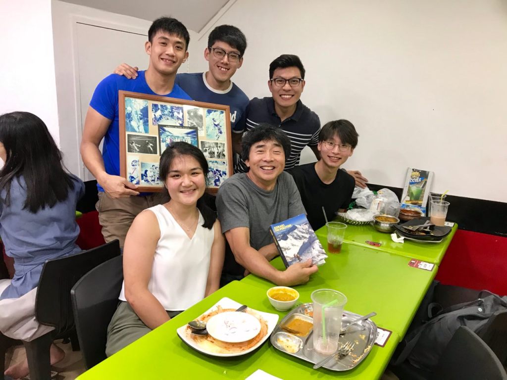
Written by: Nathaniel Soon
Edited by: Gawain Pek
The team comprising aspiring mountaineers:
Gawain Pek
Goh Jin Hao
Nathaniel Soon
Wang Chiew Hui
“Without failures I would not be here. I learned most of what I know today through them. Maybe it was my partner, or the equipment was not proper, or the training – especially the mental training, which is the most important thing – were not good enough. With success, you don’t always know why you succeed, but when you fail, it’s clear what you did wrong. Then you can make changes and learn.”
– Reinhold Messner

Great effort but most importantly , an attitude of not wanting to be handheld client with professional guides once you learnt the basics . The world is your oyster. And thanks for the mention. Two of my hardest climbs were in the Mt Cook area back in 1995 and 1996
LikeLike